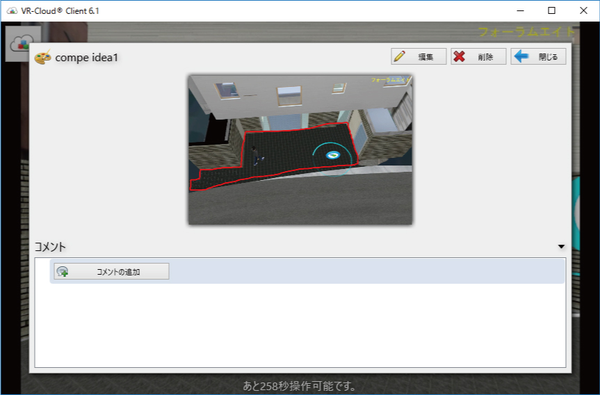
Overview |
Award/Prize |
Judging committee
Public voting |
Results |
Contest history
 |
| 3DVR simulation contest using UC-win/Road. This is held every year since 2002 when UC-win/Road won the "Software
Product of the year" award. Various brilliant works have been presented
as a main event of this festival and it has brought even more excitement
with the introduction of cloud voting via VR-Cloud® since 2011. The works are represented with the script (5min) and scenarios
and evaluation and voting are performed with cloud system. |
| |
| The 17th 3D VR Simulation Contest on Cloud Results Announcement |
|
After general voting and careful consideration by juries, Grand Prix,
2 Semi Grand Prix, 2 Essence award, Idea award, and 3 Judge's special prize
have been decided.
|
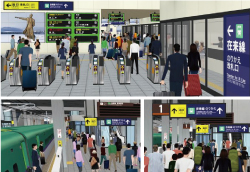
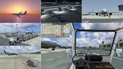
"VR simulation for Hokkaido Shinkansen Sapporo station design and
construction"
Hokkaido Railway Company |
|
|
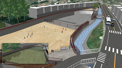
| This is a future view of
Sapporo Station that is planned to open in FY2030. Based on the current plan,
images of the station post-opening are reproduced in VR. At the first seminar of
Hokkaido Virtual Reality (VR) Promotion Council held in June 2018, a walking
simulation displaying the transit from Shinkansen to local trains was showcased.
This time, a crowd simulation shows of the predicted volume of passengers
walking in the station. In addition, this VR includes a display of digital
signage under consideration. The VR data will be used for reviews at each stage
of the plan. |
|
 |
|
|
 |
|
The detail of the current plan of Sapporo station after the opening of
Shinkansen is reproduced in this VR data, and an animation displays scenes
of passengers getting on and off the train to catch connecting train. In
addition to the flow of passengers getting off a Shinkansen on their way
to the station exit or the passage connecting to platforms for local trains,
signs and digital signages seen from the passengers' point-of-view are
reproduced in the VR data. |
|
|
|
|
 |
Semi Grand Prix |
|
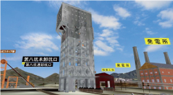
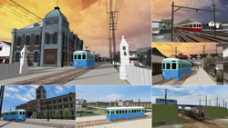
"3DVR of Winding tower in Shime mining factory and Related facilities
(in 1964)"
Tho.La.Consulting |
|
|
| The former Shime coal mine has one of the world's last three winding towers (China, Belgium, Japan) and is designated as an Important Cultural Property of Japan. Models created from photos, papers, and 3D point clouds data visualize the coal mine facilities and underground spaces at that time. |
|
 |
|
|
|
|
This huge work composed of 2 sets of VR data and point cloud data has scripts
with a total duration of tens of minutes. Focused on the appearance of
the current winding tower, the data is describing the overview and size
of former Shime mining factory and activities done in the factory by using
surrounding terrains and point clouds. As an underground scenery, hole
that is 430m deep and driftways extending to various directions from the
hole are depicted dynamically. The narrated animations showing these sceneries
are available from "シーン1・2・3:現在の説明", "点群シーン1-1:現在の説明",
and "シーン10:鉄道の説明". |
|
|
 |
|
|
|
Semi Grand Prix |
|
"VR data for ship operation simulator"
AKISHIMA LABORATORIES (MITSUI ZOSEN) INC. |
|
|
| This VR data is created for a ship operation simulator used for training and research. Narrow sea with many passing ships such as Kanmon Straits, Straits of Malacca, and Tokyo Bay are modeled in this data. Other vessels, buoys, lighthouses, and flags and lights on the ships are also modeled so that trainees can practice steering in relation to those objects. In addition, this data is used for new vessel design and other research into new technologies. |
|
 |
|
|
|
|
The animation "操船シミュレータ" shows water course signs such as buoys
seen from ship, sea area for ship operation training, and marine navigation.
One of the scenarios allows viewers to sail on the ocean with a view from
the bridge of the ship. In this data, a lot of landmarks such as Kanmon
Bridge are reproduced in the vast range of sea surface. |
|
|
 |
|
|
|
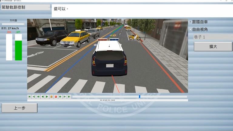
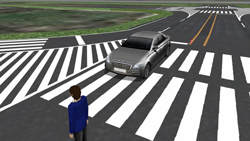
"Safety driving simulator for university students"
Central Police University Republic of China (Taiwan) |
|
|
| This is VR data for a safe driving training simulator to train police officers. In addition to simulation of normal police business related to traffic accidents, this VR data has 25 traffic event scenarios such as traffic violations by pedestrians and other vehicles and the door of a parked vehicle suddenly opening from inside, etc. in order to show correct awareness of driving behavior. The university records response time, driving behavior, and important reminders while driving and uses the data for education and training. Other traffic events are planned to be added to the simulation. |
|
 |
|
|
|
|
By executing the animation "3DVR Script", viewers can see training
contents, training with simulator, and images of determination. There are
3 driving environments to choose from. The first one consists of urban
roads, the second is a highway, and the third is a mountainous area. Each
scenario lets you experience an interactive driver training. This VR is
filled with the characteristics on Taiwan streets such as crowded avenues,
tangled alleys, and winding mountain roads. |
|
|
 |
|
|
|
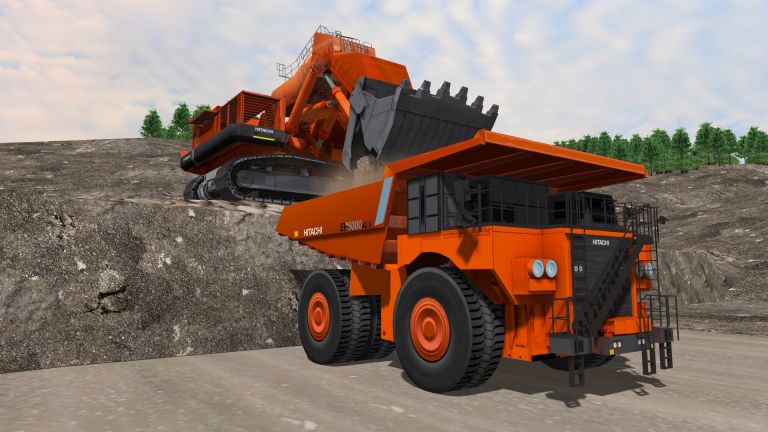
"Autonomous driving simulation of mining dump truck"
Hitachi Construction Machinery Co., Ltd. |
|
|
| This VR data is used for a simulator designed to give subjects an interactive experience of operating a mining dump truck with Hitachi Construction Machinery's autonomous driving system (AHS: Autonomous Haulage System) installed. A mining site is reproduced in VR with a scenario in which subjects must carry the load from the loading spot to a predefined unloading spot either by manual driving or using the AHS. The view from the driver's seat and the engine sound are also reproduced for a driving simulation with a sense of realism. |
|
 |
|
|
|
|
In the animation "鉱山ダンプトラック", viewers can see a landscape of
mine and heavy machines working there. The scenario "ダンプトラック運転"
shows images of the manual truck driving and autonomous driving. In this
magnificent VR space with an open-pit mine, everything is created in a
huge scale. |
|
|
 |
|
|
|
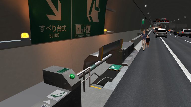
"VR simulation of evacuation from Metropolitan Expressway Yokohama
Kita line"
Kanagawa Construction Bureau, Metropolitan Expressway Company Limited |
|
|
| In the Yokohama Kita tunnel on [K7] Yokohama Kita highway line opened in March 2017, the first slide-type evacuation on Metropolitan Expressway is used. This evacuation method is also planned for installation on the Yokohama Loop line under construction. The company previously conducted PR activities of the slide-type refuge method using paper materials. This VR can show human evacuation effectively by allowing people to push the opening button of emergency exit and slide down the evacuation slides that are normally unavailable. This VR data is used at events held at an off-expressway parking area and at local events, and participants can understand the evacuation methods while having fun. It will be also provided as a 360-degree video so that it can be further utilized as a tunnel disaster prevention tool. |
|
 |
|
|
|
|
The scenario "避難シミュレーション" allows viewers to experience an evacuation.
Along with automatically played scenes, viewers can hear the real announce
from the loudspeaker encouraging evacuation and check important points
and correspondence at the time of evacuation from accidents. The scenario
includes how to use refuge facilities including evacuation slide that are
unavailable at ordinary times, thus viewers can see a variety of safety
equipments inside tunnel. |
|
|
 |
|
|
 |
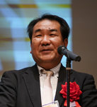
Produce Award
Mr. Fumio Seki Professor of Engineering department, Nihon University
(Chief of the judging committee) |
|
"Test VR data for projection mapping on Enyuuji Temple"
Tendaishu Kyououzan Monjuin Enyuuji |
|
|
| This VR data was created for the consideration of potential events at Tendaishu Enyuuji temple in Meguro, Tokyo, which was established in 853. The data reproduces scenery from the temple entrance to the Shakado. It can be used for the consideration of projection mapping on the Shakado and for a simulation to guide many spectators around the temple by using the crowd movement function. In addition, results of the potential impact of events including the results of evacuation analysis and noise simulation are also visualized in VR. |
|
 |
|
|
|
|
The animation "円融寺シミュレーション" shows you the sceneries in the temple
and the considerations of event contents. You can see historical architectures
such as Shakado and Nio-mon gate and a flow of projection mapping. In addition,
assessments such as an evacuation simulation at events and a noise analysis
are also displayed. It is a very unique VR that a historical temple is
collaborated with the newest simulation. |
|
|
 |
|
|
|
Products Award
Mr. Hiroo Kasagi (Representative of NPO Chiikizukuri Kobo) |
|
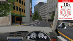
"Dual drive EPS system simulator"
DENSO Corporation |
|
|
| This exhibition system consists of a hardware configuration for EPS (Electric Power Steering) assisted steering force, linked with a servo motor simulating steering loading and VR data with street and highway models and scenario settings. Normal motion and abnormal motion are reproduced in both the existing EPS and dual drive EPS to assess the system effectivity. This simulator was showcased at events around the world including motor shows in Frankfurt and Tokyo. |
|
 |
|
|
|
|
This course data has many curves so that the existing EPS and the dual
drive EPS can be compared in a comprehensible way. By executing a scenario,
viewers can see the operation of EPS while driving, comparing the existing
type and the dual drive EPS. Two driving courses, one for left-hand traffic
in Japan and another for right-hand traffic in Europe are available, which
allow viewers to drive in different landscapes. |
|
|
 |
|
|
|
Project Award
Mr. Tatsuoki Inagaki (Director of Pave & Road How-To Way Technology
Association) |
|
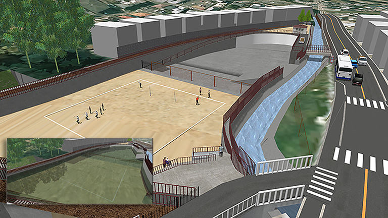
"VR data utilized for Nanase River renovation plan"
Kyoto Kogakuin High School |
|
|
| This VR data was created for a community meeting to explain about the Nanase River development in Kyoto city. Specifically, it was used to explain the installation of a detention basin against localized heavy rain, and environmental improvement. High school students provided proposals for the utilization of the basin in normal times, and it was indeed a special activity for them as they cannot experience such a productive activity in school classroom. |
|
 |
|
|
|
|
The animation "平成30年度 七瀬川改修計画" shows the background of the request
from Kyoto City, the work flow of data creation, and the landscapes of
renovated retarding basin at ordinary times and at heavy rain. Roads for
maintaining the river, the explanation of barrier-free, and proposals about
a bus bay and a multipurpose square are also described simply. The data
also includes the meeting with residents. |
|
|
 |
|
|
|
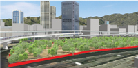
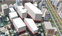
"High resolution satellite photos applied to VR building and terrain
models"
Mitsui Consultants Co., Ltd. |
|
|
| From the perspective of responsibility for explanation, the smooth building of consensus with the local community about major projects involves review of internal views from a user perspective and sunshine impact using VR that is one of the CIM/BIM solutions. In this simulation, detailed terrain and buildings provided by the recent advanced satellite photo technology are efficiently utilized. In addition, dynamic sounds are inserted in the simulation. |
|
 |
|
|
|
|
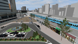
By executing the animation "コンテストイメージ", viewers can see the background
of usage of building and terrain models based on high resolution satellite
photos and the explanation of the previous problem solutions. An examination
on a plan to improve the area in front of a station and a sunshine simulation
on that area are conducted using the 3D VR building models in UC-win/Road
based on the real buildings around the target environment. Viewers can
listen to the BGM playing in the background that goes well with the animation. |
|
|
|
|
|
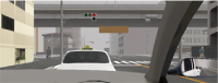
"Testing of ADAS function of Vehicle-in-the-Loop system using UC-win/Road"
Hyundai Motor Group |
|
|
| VR data of a test course to test an ADAS system by making a real vehicle and VR vehicle model interoperate with each other. The driven vehicle is reproduced on the VR course in real time with the help of GPS, and during the drive other vehicles that do not exist on the real track also emerge in VR. A test environment is built to verify whether the ADAS system on the vehicle responds correctly to other VR vehicles and helps avoid accidents. |
|
 |
|
|
|
|
The animation "introduction" shows images describing how the
ADAS system is tested. In addition, viewers can experience the situations
used for system tests by executing the scenario "運転開始". In the
scenario, virtual vehicles that do not exist in real emerge and hazardous
situations are reproduced. |
|
|
|
|
|
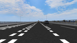
"Evaluation of road markings for speed reduction on Wuhan Yangtze
Great Bridge"
Wuhan University of Technology |
|
|
| To evaluate the most effective road markings for speed reduction, 14 patterns of road markings that encourage drivers to slow down were created and painted on Wuhan Yangtze Great Bridge in UC-win/Road for an assessment of their effectiveness through driving simulation. Each road marking stretches for 300m and a 2000m interval is placed between them to help return drivers to normal driving condition. In addition, driving tests were conducted in both high and low traffic volume in order to analyse intervehicle spacing characteristics in different traffic flows. The driving scenario covers a long stretch of bridge pavement with a total length of 70 km. Two road marking patterns were selected after the driving experiment and were actually installed on Wuhan Yangtze Great Bridge. |
|
 |
|
|
|
|
The animation "introduction" shows road marking patterns and
driving image, and scenarios let you feel the effects of road markings
seen from the driver's seat. In addition to 14 kinds of road markings,
the result of the actual installation of 2 patterns selected after the
test are explained. This very simple data with rough scenery is specialized
for a review of safety measures. |
|
|
|
|
|
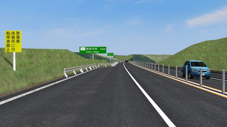
"VR construction management - utilization of 3D in paving work -"
DOROKOGYO Co., Ltd. |
|
|
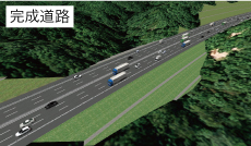
| A total of 6.0km road that will be newly constructed in Kushiro Town, Hokkaido is recreated in 3D in this project. 3D models are used for each construction management scene such as a review of the asphalt transportation route, a safety education using VR headsets, study of roadside object locations, and the sharing of an image of the completed project. Such visualizations have been very useful for productivity improvement and construction visualization. |
|
 |
|
|
|
|
The animation "新設道路" shows images of the completed road and its
overall view from the driver's seat including the roadside objects. Near
the end of the the animation, the viewer can get a better idea of how an
onsite safety training for construction workers is performed. In one of
the scenarios, potential dangers during construction can be seen from the
perspective of a driver operating a heavy machine, and several options
for safety countermeasures are explained through simulation. |
|
|
|
|
|
 |
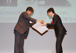
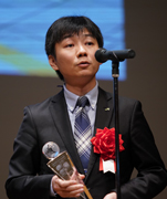
■Grand Prix
GALLERIA high performance gaming notebook /
Portable SSD / Certificate / Trophy / Book card |
|
■Semi Grand Prix
DJI Mavic Air (with 4K panorama camera) /
Certificate / Book card |
■Idea Award
■Essence Award
GALLERIA gaming notebook / Certificate / Book card |
|
■Judge's Special Award
Action cam GoPro HERO6 (for 4K60 video)
Certificate / Book card |
| |
■Nomination Award
Certificate / Book card |
|
PCs are provided by THIRDWAVE Corporation
*No dual recipients |
| |
Profile of Judging Committee |
 |
Mr. Fumio Seki
Professor of Engineering department, Nihon University
After graduating the department of science and engineering, Nihon University,
he joined Design Planning office for civil design of Taisei Corporation
and has been engaged in design etc. for road structure, river, harbor and
lecture etc. Appointed in the current position since 2011. |
 |
Mr. Hiroo Kasagi
Representative of NPO Chiikizukuri Kobo
Director of Japan Society for Impact Assessment, director of Laboratory
of Autonomy Problem, part-time instructor of Nagano University, CEO of
Kizakiko Hot Spring Development Co., Ltd. Councilor of Omachi Kita high
school. Author of some books. Won the prize of Minister for the Environment
for his activity of global warming in 2005. |
 |
Mr. Tatsuoki Inagaki
Director of Pave & Road How-To Way Technology Association
Holding a post of information technology manager at Road Management Technology
Center and currently taking on a director of Pave & Road How-To Way
Technology Association. Author of some books about pavement engineering
and road engineering.
He is engaged in improvement of technology of road and pavement and promotion
of research development. |
Flow of Contest
 |
 |
 |
|
 |
|
 |
|
 |
Guideline for
applicants |
|
Nominated Works |
|
Go to Vote
Ended |
|
Awarded Works |
Tue. 9 Oct. 2018 Deadline for works submission
Deliverable
- VR data created via UC-win/Road (script is required to be created and the work is needed to be stored in media such as CD-ROM and DVD etc.)
- Overview of VR data (up to 150 words) and how to operate the data
Where to deliver the data
Please tell your contact person of FORUM8 staff and send it to him/her. |
 |
 |
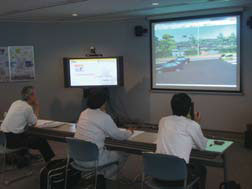
Tue. 16 Oct. 2018 Meeting for selecting nomination works
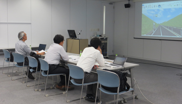 |
 |
Meeting for selecting nomination works
at Seminar Room in FORUM8 Head Office |
Judging Committee
(From the left) Mr. Tatsuoki Inagaki,
Mr. Fumio Seki
(Chief of the judging committee),
and Mr. Hiroo Kasagi |
|
Fri. 2 Nov. - Sun. 11 Nov. 2018 Period of public voting on cloud

|
Public Voting on Cloud
|
|

|
|
Vote via VR-Cloud® ! |
|
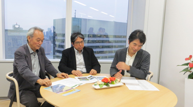
Tue. 13 Nov. 2018 Examining Meeting at FORUM8 Tokyo head office MAP
Meeting for selecting nomination works
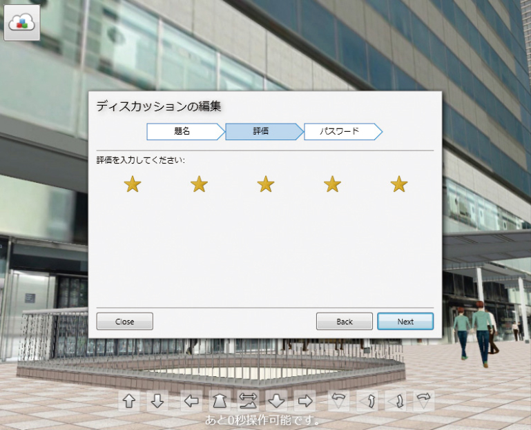
The judgment will be performed by 30% of public voting, 70% of voting from
judging committee based on the ranking point and ranking point for special
awards. |
 |
|
Wed. 14 Nov. 2018 Shinagawa INTERCITY Hall MAP
Award Ceremony of the 17th 3DVR Simulation Contest on Cloud |
Guidelines for application
| Deadline for works submission |
Tue. 9 October 2018 |
| Deliverable |
- VR data created via UC-win/Road (script is required to be created and
the work is needed to be stored in media such as CD-ROM and DVD)
- Overview of VR data (up to 150 words) and how to operate the data |
| Where to deliver the data |
Please tell your contact person of FORUM8 staff and send it to him/her. |
| Copyright |
All contents of the awarded VR data is the copyright of each applicants.
The submitted VR data will not be distributed, but FORUM8 has a right to
use the data and works, edit and reproduce the images and videos etc. and
post or introduce it on website, magazines, books, and newspaper etc. as
a sales activity or an advertisement as a secondary user of VR data. Please
be forewarned. |
| Inquiries for the application |
Please tell your contact person of FORUM8 staff. |
Meeting for selecting
nomination works |
Nomination works Nominated works will be decided on Tue. 16 October 2018.
Meeting for selecting nomination works on Tue. 16 October 2018 |
Related Products
 |
64bit Native support |
●Improvement of road modeling
Enhancement of "Road Section Details" |
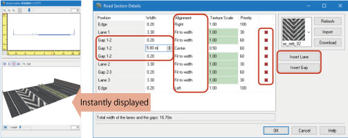 |
3D preview is updated dynamically.
Edit result can be checked instantly. |
 |
| A flexible designing of carriageway |
●Zone function
Free range definition
various calculation and operation |
 |
 |
Left: forest creation
Right: block and building, area calculation |
|
|
Ver.13 New features |
|
|
Simulation functions |
●Replay plugin
Addition of sound recording, auto save, search of replay file |
●Cluster system
- Camera data transmission - |
| ●Customization of each scenario |
●Weather expression
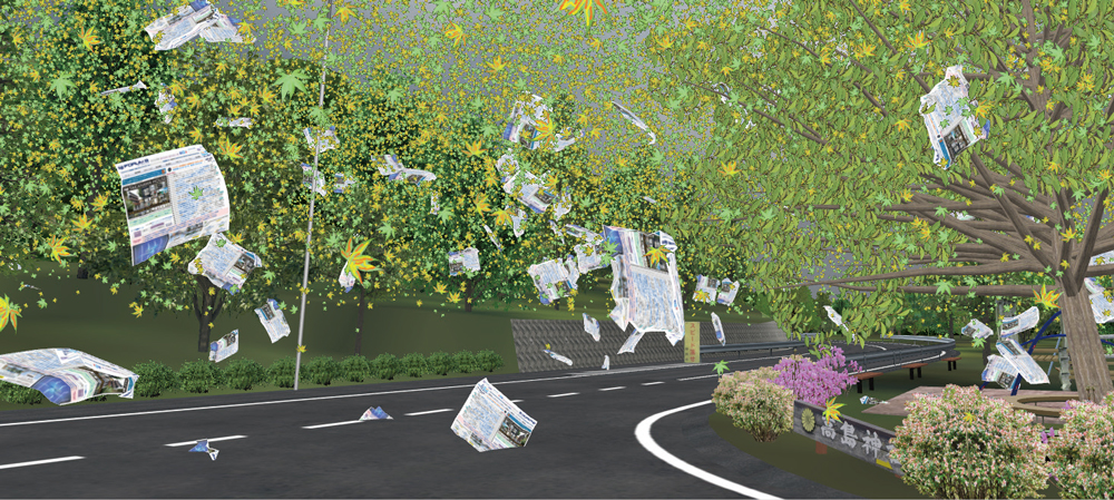
- Fluttering leaves and clothes
- Meter setting for Mist: Linear |
 |
 |
|
Enhancement of
device linkage |
|
|
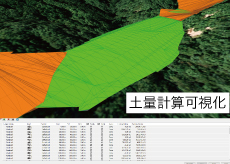
Earthwork volume calculation |
| Calculate approximate volume of earthwork by using the 3D shape of roads
and terrains created in the software |
 |
  Switch by 1 click Switch by 1 click |
 |
| Soil calculation setting |
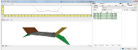 |
| Section editor / Dynamic generation of default section |
|
|
 
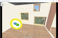
VR-Cloud® is a consensus building solution which uses 3D and VR on a cloud
server. With only internet access environment, even thin client would be
able to operate the VR space by web browser.
| ■VR-Cloud® Collaboration |
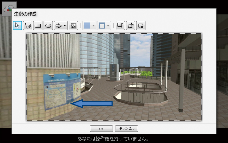
| Advanced VR which supports consensus formation on cloud, such as 3D bulletin
board function and annotation function, etc. is possible. |
 |
 |
 |
 |
 Landscape evaluation Landscape evaluation |
Annotation function |
3D icons |
Contents viewer |
|
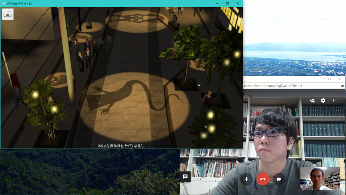
| Case study: "Mizuki Shigeru Road x VR-Cloud® Ver6.1" |
|
|
|
 |
 |
| In a renewal plan of Mizuki Shigeru Road promoted in
Sakaiminato city, VR data of the concrete plan is created
and shown to persons concerned and citizens for PR
and a consensus building of the design plan.
The VR-Cloud® is used for a remote design meeting by
sharing the data. |
|
| by Tomohiro Fukuda laboratory of environment and energy engineering, Graduate school of Osaka University |
|
|
| |
Introduction of the past awarded works |
|
|