Overview |
Award/Prize |
Judging committee
Public voting |
Results |
Contest history
 |
| 3DVR simulation contest using UC-win/Road. This is held every year since 2002 when UC-win/Road won the "Software
Product of the year" award. Various brilliant works have been presented
as a main event of this festival and it has brought even more excitement
with the introduction of cloud voting via VR-Cloud® since 2011. The works are represented with the script (5min) and scenarios
and evaluation and voting are performed with cloud system. |
| |
| Results Announcement of The 16th 3D VR Simulation Contest on Cloud |
|
After general voting and careful consideration by juries, Grand Prix, Semi
Grand Prix, Essence award, Idea award, and 3 Judge's special prize have
been decided.
|
"Education training of Haneda Airport by VR simulator"
Meiwa Sky Support Co., Ltd. |
|
|
| This is VR driving simulator data for the purpose of promoting and training
safe driving throughout Haneda Airport. The airport is a special environment
and driving rules are different from that of ordinary roads. In addition
to the roads and facilities in the airport, special vehicles and aircraft
found in the airport are reproduced in this VR which is designed to educate
and train drivers who have to cope with hazardous places and points that
demand special attention whilst driving throughout the airport. |
|
|
 |
|
By executing the animation "Haneda Airport", viewers can see
the content of the training programmes for drivers of pushback tractors
that pull containers, vehicles that run throughout the airport and the
daily scenes within Haneda Airport. The "Cargo vehicle driving"
is a particular scenario that enables the viewers to drive a pushback tractor.
The tractor driver must safely navigate the special airport environment,
wait for aircraft crossing and reach the end goal. It is not just training
data, as the system enables the viewers to experience the atmosphere generated
by the many airport workers. |
|
|
|
|
 |
2nd Prize |
|
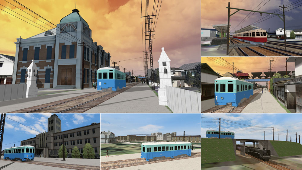
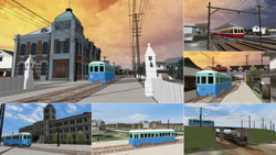
"Reproduction of the tramway line and its surroundings in Omuta city"
Keisuke Ijiri office |
|
|
| This is the second revival of the Omuta tramway that was once familiar
to the citizens as the main facility of transportation. The buildings of
Mitsui Chemicals, Miike Bank, Matsuya Department store, and Omuta Station
that represent those days are reproduced along the rail track. In addition
the 500 series train is also shown calmly running in the scenery. The landscape
of the Mikawa mine is also shown as is the Mitsui Miike coal mine, along
with huge facilities such as wooden houses and the coal mine machine hoppers.
The crowd in Omuta at the time can be seen from the tram. |
 |
|
 |
|
|
|
|
The animation "Tramway experience" takes viewers back in time.
All the objects in the view such as the old cities, girder bridges, crossing
trains, and the stately architecture are picturesque. In the animations
expressing each scene, the viewers can see trams arriving and departing,
the buildings mentioned and the 500 series trains. |
|
|
|
|
|
2nd Prize |
|
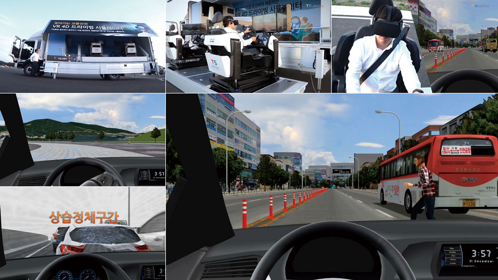
"Mobile type safety education experience 4D VR simulation"
Korea Transportation Safety Authority |
|
|
| This data was created for use with the 4D traffic safety simulator. It
cosists of various driving courses including an urban street and a highway,
including a number of driving scenarios. For example, emergency events
and hazardous scenes such as traffic merging, pedestrian traffic violations,
and the effects of smartphone operation during driving are reproduced.
It is also possible to experience two different types of driving simulations,
one using normal monitors and the other using VR glasses, both while driving
the simulator with a 6DOF motion platform. The 4D simulator is installed
in a mobile container truck so people within Korea will be able to experience
this simulation. |
|
 |
 |
|
|
|
|
This safe driving 4D simulator has three scenarios. The "Urban roads"
scenario includes unauthorized crossing, right turn, and danger avoidance.
The "Highway" scenario includes experiences of drowsy driving,
danger prediction, congestion, merging and a construction section. Finally,
in the "Testing location" scenario, viewers can experience dangerous
situations such as low friction roads, slalom driving and sudden braking
that cannot be easily experienced on ordinary 'real' roads. Since every
case is perfectly possible in real life, it may be said that this data
will lead us to change how we think in our daily driving. |
|
|
|
|
|
"Integration of 3D models from sewerage pipe line investigation data"
Kanro Jyoho Katsuyo Yugen Sekinin Jigyo Kumiai
(Limited Association of Pipeline Data Utilization) |
|
|
| The integration of the 3D visual models of all underground structures,
including pipe line data produced during "reconstruction and repair"
of the pipeline, enables the maintenance management and repair / design
(civil engineering) of specific structures. In addition, not only sewage
administrators but disaster staff can share the model as and when required,
for example during earthquakes. In the future, it will be possible to determine
the water discharge and conduct civil engineering reconstruaction simulations
from the disaster refuge sites. |
|
 |
 |
|
|
|
|
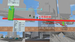
The animation "Sewer script" shows the underground pipeline facilities
in the 3D space that one cannot see normally. The data is set around Kuramae,
Taito-ku, Tokyo, and viewers can experience both of outside and inside
of the buried pipe of about 300 meters long. The shape of the sewer pipe,
entrances and exits, and passages inside the pipe created in detail can
be seen at each camera position. |
|
|
|
|
|
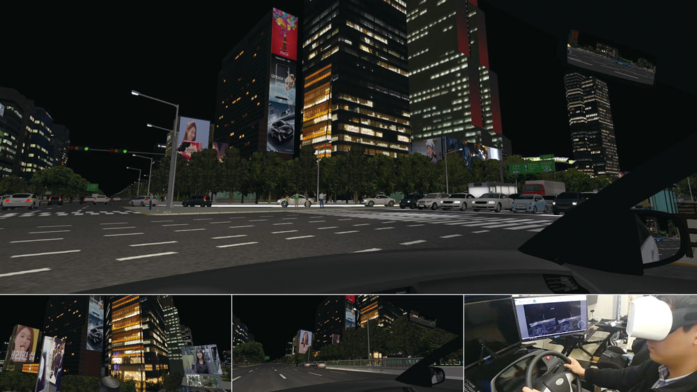
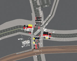
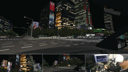
"VR for research on the effects of digital signage on driving operation
and driver performance"
University of Seoul |
|
|
| The use of large digital signage installed on the street and outside high-rise
buildings has increased in recent years. In order to research what effects
such large scale digital signage has on safe driving, the central part
of Gangnam area in Seoul was reproduced in VR, and experiments using a
driving simulator were conducted. The log data of the driver’s line of
sight as well as the individual drivers driving log data were recorded
and analyzed by the use of the FOVE new eye tracking HMD. |
|
 |
 |
|
|
|
|
By executing the scenario, viewers can experience driving in the city at
night. Several digital signs are included to block the building lights
and attract the driver's attention. The question the 3D driving VR asks
is will it be possible to continue driving safely while seeing a beautiful
night view and eye-catching digital signage? |
|
|
|
|
 |
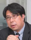
Design Award
Mr. Fumio Seki Professor of Engineering department, Nihon University
(Chief of the judging committee) |
|
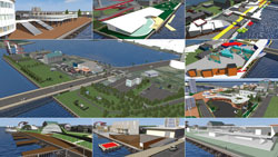
"A redevelopment proposal based on a model of the maritime area in
Kisarazu city"
Kisarazu city |
|
|
| A proposal for the redevelopment of the maritime area of Kisarazu city
along with the work of the participants' is introduced in this VR. The
data, which is set in a seaside park on a peninsula, contains unique proposals
whose aim is to enhance the charm of the area. The viewer is able to experience
the appeal of the proposed redevlopment by seeing it from the images and
by means of the walkthrough. |
|
 |
 |
|
|
|
|
By viewing the animation "Site overview", one can experience
the whole seaside park. The green park and the people walking and jogging
in it can be seen. There is an animation for each of our unique redevelopment
proposals. Viewers are able to see these attractive redevelopment proposals
from a variety of viewpoints including ground level, car, ship and bird. |
|
|
|
|
|
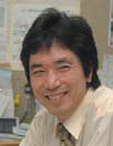
Regional Construction Award
Mr. Hiroo Kasagi (Representative of NPO Chiikizukuri Kobo) |
|
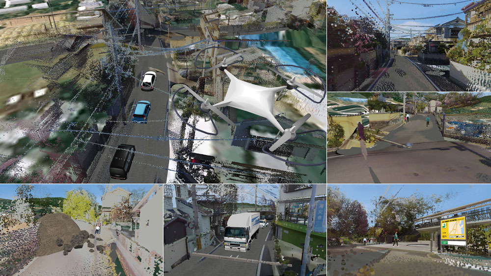
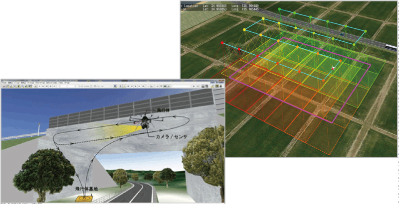
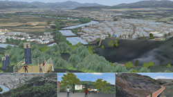
"A proposal for the emergency planning using VR of a huge earthquake"
Fushimi Technical High School in Kyoto (Kyoto Kogakuin High School) |
|
|
| A variety of potentially huge earthquakes may occur in the near future
and may cause unexpected damage. By capturing images of disaster situations
immediately after the earthquake with a multicopter and converting them
to point cloud data, by sfm analysis, the resultant emergency disaster
compliant VR will be useful for the planning of evacuation and the supply
of relief goods. |
|
 |
 |
|
|
|
|
The presentation starts when the animation "Countermeasure proposal
for large scale earthquake". A number of unique and flexible ideas
from high school students using the latest technologies are included in
this comprehensive proposition. The contents of the proposal include the
response to the disaster, damage prediction and visualization of the current
situation following large scale earthquake. The main content of this proposal
is a visualization using the point cloud display rather than a detailed
creation of data. |
|
|
|
|
|
Future Development Award
Mr. Tatsuoki Inagaki (Director of Pave & Road How-To Way Technology
Association) |
|
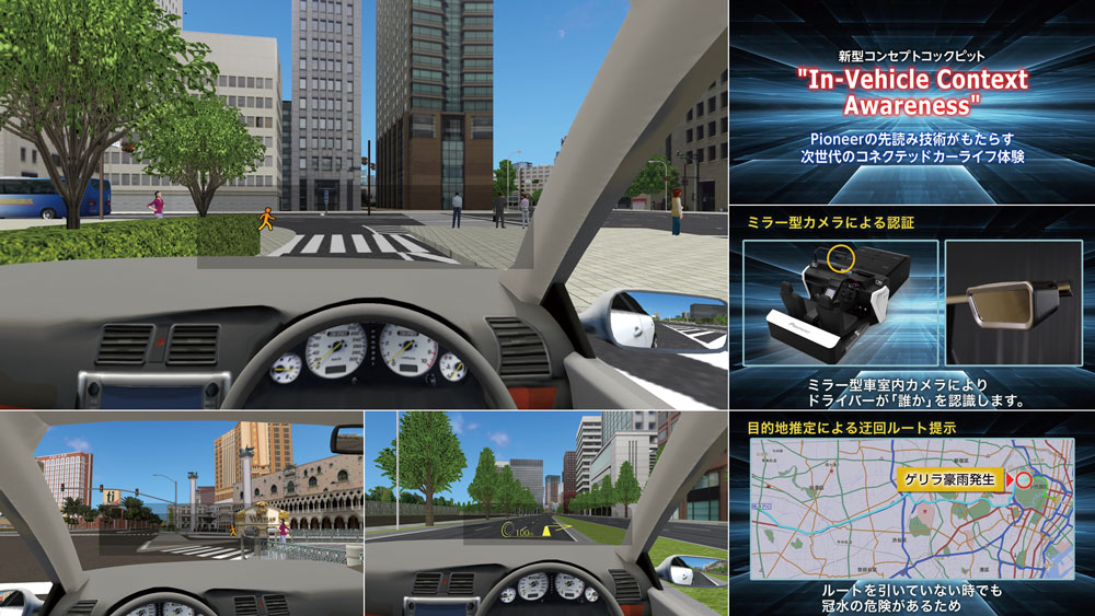
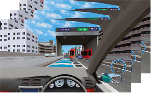
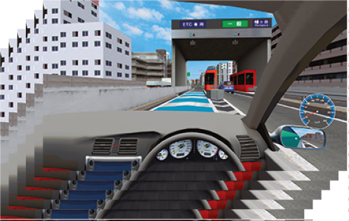
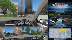
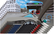
"HMI VR cockpit simulation during autonomous driving"
PIONEER CORPORATION |
|
|
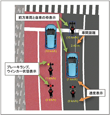
| This project deals with the "In-Vehicle Context Awareness (IVCA)"
concepts and the planning related to the HMI (Human Machine Interface)
within autonomous vehicles. The project includes the VR data and VR system
designed to actually develop, deploy and verify its effectiveness. In addition
to the verification, it is to be exhibited as part of 'the future' at the
Tokyo Motor Show, CES, etc. |
|
 |
 |
|
|
|
|
In this VR data, driving simulation scenarios can be executed in both the
urban areas of Tokyo and Las Vegas. Information is displayed on the screen
during the driving simulation and viewers can experience the image of "IVCA"
which is a driving support system of the future. The 3D VR environment
is comprised of the center of Tokyo with skyscrapers of the urban city
and the reproduction of gorgeous Las Vegas in Nevada, US. |
|
|
|
|
|
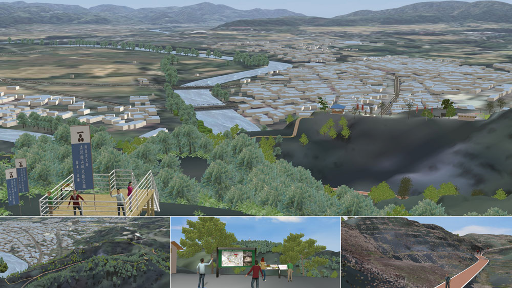
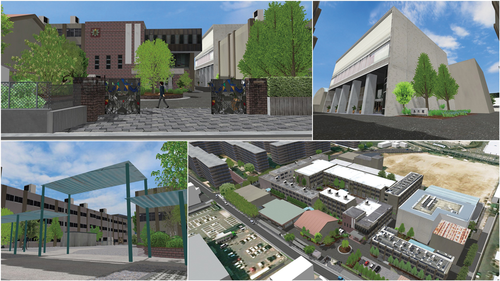
"A proposal for the initial improvement of the government-designated historic site of the ruin of Aterazawa Tateyama castle in Oe, Yamagata using 3D point cloud data"
Sagae Survey Civil Engineering Co., Ltd. |
|
|
| The characteristic structure and surrounding terrain of the ruined castle is recreated using a 3D laser scanner. In addition to the structure of the castle the 3D data also captured scenes of the vast basin and the Mogami-gawa river at the base of the mountain. |
|
 |
|
|
|
|
In the animation "Panoramic view of the Aterazawa Tateyama castle
ruin", viewers can enjoy fully the whole area of this government-designated
historic site and the view from the summit in about four minutes. It starts
from a bird's eye view and goes through four paths in the castle to the
viewing platform on the summit Hachimanza while showing the beautiful natural
sceneries and historic surroundings. It is hoped that viewers of this VR
will afterwards wish to visit the actual site. |
|
|
|
|
|
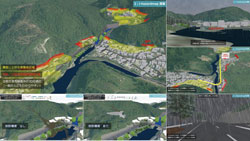
"i-hazard map PROJECT -Proposal of the next generation i-hazard map
concept-"
Mitsui Consultants Co., Ltd. |
|
|
| This project proposes a new concept related to the "i-hazard map"
such as a new debris flow map and an advance in the publishing of predicted
rain by effectively utilizing the latest VR technologies in order to simply
and appropriately convey the risk information, including disasters. Moreover,
it shows the application of this hazard map and future methods of operation. |
|
 |
|
|
|
|
In the animation "i-hazard map PROJECT", viewers can see how to simply explain to the general public a variety of information in VR, such as the prediction of landslide disasters due to possible global warming and the creation of the hazard map based on the rainfall forecast.
A display of hazardous areas, intensity of rainfall, and the danger of driving in heavy rain are shown in an easy-to-understand way. In addition, this data also precisely explains the search of near refuge places and evacuation routes, the image of the landslide, and the necessity of debris dam. |
|
|
|
|
|
 |
|
■Grand Prix
Certificate / Trophy /
15.6 inch gaming notebook /
Book Card |
|
■Exellence Award
Certificate / Book Card / DJI Mavic (with 4K camera) |
■Idea Award
■Essence Award
Certificate /
MSI notebook /
Book Card
|
|
■Judge's Special Award
Certificate /
Omnidirectional camera THETA S /
Book Card |
| |
|
■Nominate Award Plaque / Book Card |
|
No dual recipients |
| |
Profile of Judging Committee |
 |
Mr. Fumio Seki
Professor of Engineering department, Nihon University
After graduating the department of science and engineering, Nihon University,
he joined Design Planning office for civil design of Taisei Corporation
and has been engaged in design etc. for road structure, river, harbor and
lecture etc. Appointed in the current position since 2011. |
 |
Mr. Hiroo Kasagi
Representative of NPO Chiikizukuri Kobo
Director of Japan Society for Impact Assessment, director of Laboratory
of Autonomy Problem, part-time instructor of Nagano University, CEO of
Kizakiko Hot Spring Development Co., Ltd. Councilor of Omachi Kita high
school. Author of some books. Won the prize of Minister for the Environment
for his activity of global warming in 2005. |
 |
Mr. Tatsuoki Inagaki
Director of Pave & Road How-To Way Technology Association
Holding a post of information technology manager at Road Management Technology
Center and currently taking on a director of Pave & Road How-To Way
Technology Association. Author of some books about pavement engineering
and road engineering.
He is engaged in improvement of technology of road and pavement and promotion
of research development. |
|
Guidelines for application
| Deadline for works submission |
Tue. 10 October 2017 |
| Deliverable |
- VR data created via UC-win/Road (script is required to be created and
the work is needed to be stored in media such as CD-ROM and DVD)
- Overview of VR data (up to 150 words) and how to operate the data |
| Where to deliver the data |
Please tell your contact person of FORUM8 staff and send it to him/her. |
| Copyright |
All contents of the awarded VR data is the copyright of each applicants.
The submitted VR data will not be distributed, but FORUM8 has a right to
use the data and works, edit and reproduce the images and videos etc. and
post or introduce it on website, magazines, books, and newspaper etc. as
a sales activity or an advertisement as a secondary user of VR data. Please
be forewarned. |
| Inquiries for the application |
Please tell your contact person of FORUM8 staff. |
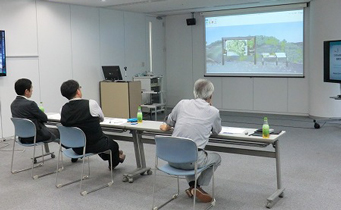
Meeting for selecting
nomination works |
Nomination works Nominated works will be decided on Tue. 17 October 2017.
Meeting for selecting nomination works on Tue. 17 October 2017 |
Flow of Contest
Tue. 10 Oct. 2017 Deadline for works submission
Deliverable
- VR data created via UC-win/Road (script is required to be created and the work is needed to be stored in media such as CD-ROM and DVD etc.)
- Overview of VR data (up to 150 words) and how to operate the data
Where to deliver the data
Please tell your contact person of FORUM8 staff and send it to him. |
 |
 |
Tue. 17 Oct. 2017 Meeting for selecting nomination works
 |
 |
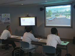
Meeting for selecting nomination works
at Seminar Room in FORUM8 Head Office |
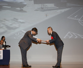
Judging Committe
(From the left) Mr. Tatsuoki Inagaki,
Mr. Fumio Seki (Chief of the judging committee),
and Mr. Hiroo Kasagi |
|
Sat. 4 Nov. -Sun. 12 Nov. 2017 Period of public voting on cloud
|
Tue. 14 Nov. 2017 Examining Meeting at FORUM8 Tokyo head office MAP
Meeting for selecting nomination works
The judgment will be performed by 70% of public voting, 30% of voting from
judging committee based on the ranking point and ranking point for special
awards. |
 |
|
Wed. 15 Nov. 2017 Shinagawa INTERCITY Hall MAP
Award Ceremony of the 16th 3DVR Simulation Contest on Cloud |
Related Products
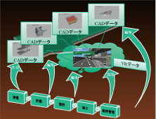
VR-Design Studio
 |
64bit ver. / 32bit ver. |
|
|
 |
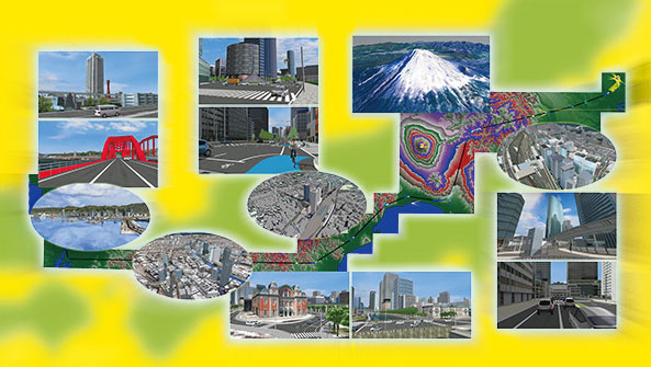
| Nowadays everyone's talking about VR, but we FORUM8 have been developing Interactive 3D VR Simulation and Modeling Software "VR-Design Studio" (aka UC-win/Road) that allows its users to not only use the VR environment the software has to offer but also build one since the 20th century well before our competitors. |
|
| All it takes to build a 3D VR environment is 1 PC, 1 software package,
and a simple mouse operation; no special knowledge or programming required.
Some may think building a 3D VR environment themselves is difficult unless
they have top-notch programming skills, but to their surprise we now have
thousands of VR-Design Studio users from small children to veteran engineers
creating their own unparallel VR world with common operations. "Creating
VR" has become a reality. The software creates a 'forum' within VR
space that brings together various 3rd party software products under one
roof for seamless collaboration. FORUM8 customers can have VR-Design Studio
software customized to meet their own individual specification either by
themselves using the Software Development Kit (SDK) or by contracting with
us to benefit from our system integration service. |
64bit Native support
Use UC-win/Road without memory limit!
Much faster, larger, and more efficient |
 |
|
|
2D view
Enhanced display including vehicle situation |
 |
 |
 Show only road, car, and pedestrian Show only road, car, and pedestrian |
Show attached data |
|
Calculation frequency control and SILS function
Independent management of drawing cycle and calculation cycle |
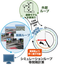 |
Image of internal process
(Drawing 60hz / Calculation 100hz) |
 |
| Drawing period 60hz |
 |
| Drawing period 100hz |
|
|
|
Linkage with 3DCAD Studio®
Designed structures can be imported
to VR spaces |
 |
UAV plug-in: mapping function
Setting UAV flightpath |
 |
|
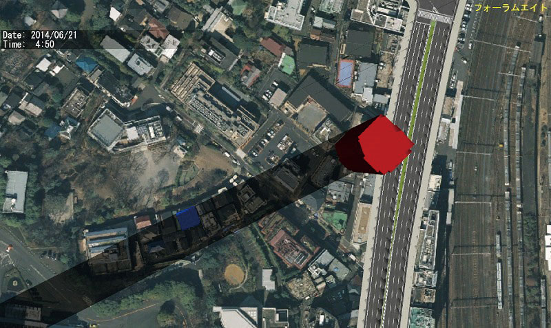
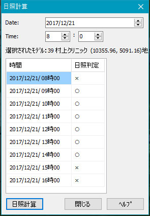
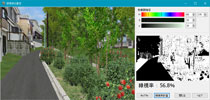
| Environmental assessment plug-in |
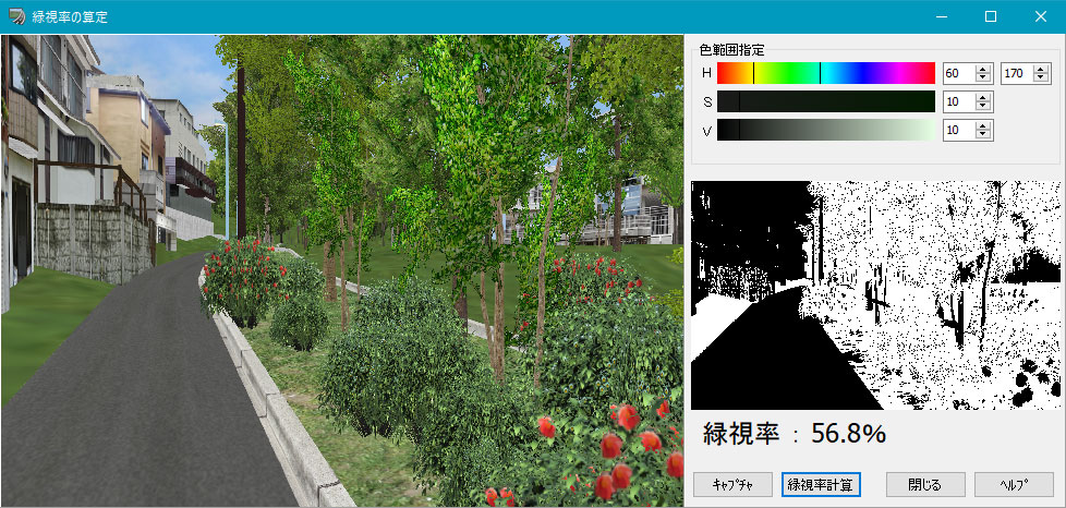
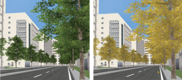
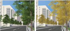
With the Planting Plug-in, environmental impact assessment using detailed tree models becomes feasible.
-Potential landscape impacts of a project such as the change in green coverage
rate, sunlight blockage,
and sunlight reflection issues can be predicted.
-Solar angle/elevation can be assigned to retrieve sunlight reflection angles for simulation through a VR environment.
 |
 |
 |
 |
| Green coverage rate calculation |
Sunlight and shadow analysis |
Solar Panel Reflection Check |
 Link Link |
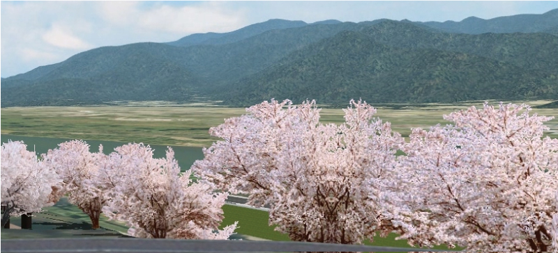
| Planting plug-in |
| Create complex shape trees by simple operation |
 |
 |
 |
|
|
 
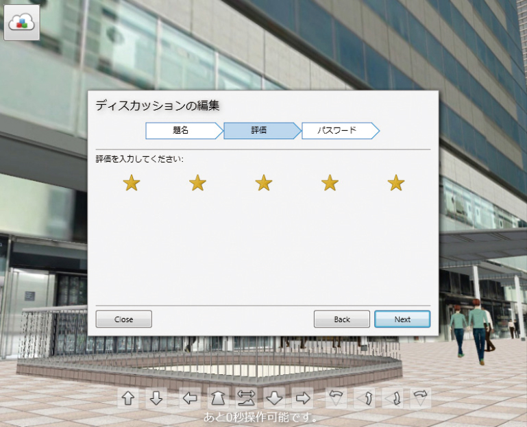
VR-Cloud® is a consensus building solution which uses 3D and VR on a cloud
server. With only internet access environment, even thin client would be
able to operate the VR space by web browser.
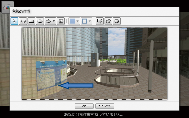
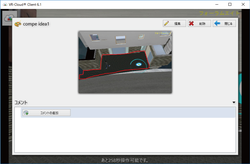
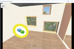
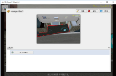
| ■VR-Cloud® Collaboration |
| Advanced VR which supports consensus formation on cloud, such as 3D bulltin
board function and annotation function, etc. is possible. |
 |
 |
 |
 |
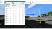
| Landscape evaluation |
Annotation function |
3D icons |
Contents viewer |
|
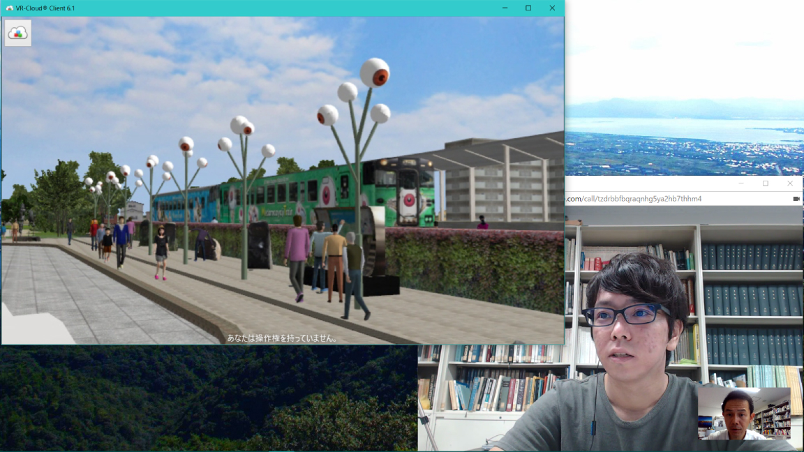
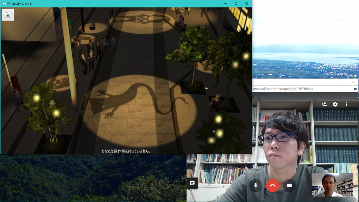
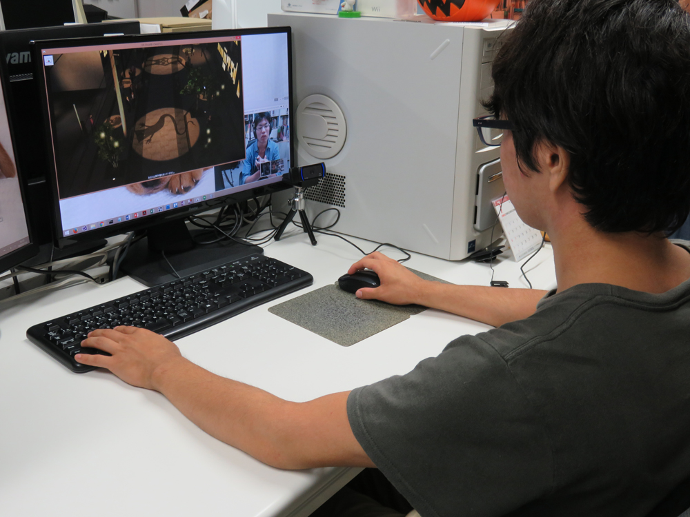
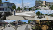
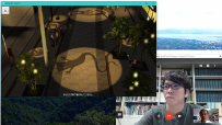
| Case study: "Mizuki Shigeru Road x VR-Cloud® Ver6.1" |
|
|
|
 |
 |
| In a renewal plan of Mizuki Shigeru Road promoted in
Sakaiminato city, VR data of the concrete plan is created
and shown to persons concerned and citizens for PR
and a consensus building of the design plan.
The VR-CloudR is used for a remote design meeting by
sharing the data. |
|
| by Tomohiro Fukuda laboratory of environment and energy engineering, Graduate school of Osaka University |
|
|
| |
Introduction of the past awarded works |
|
|